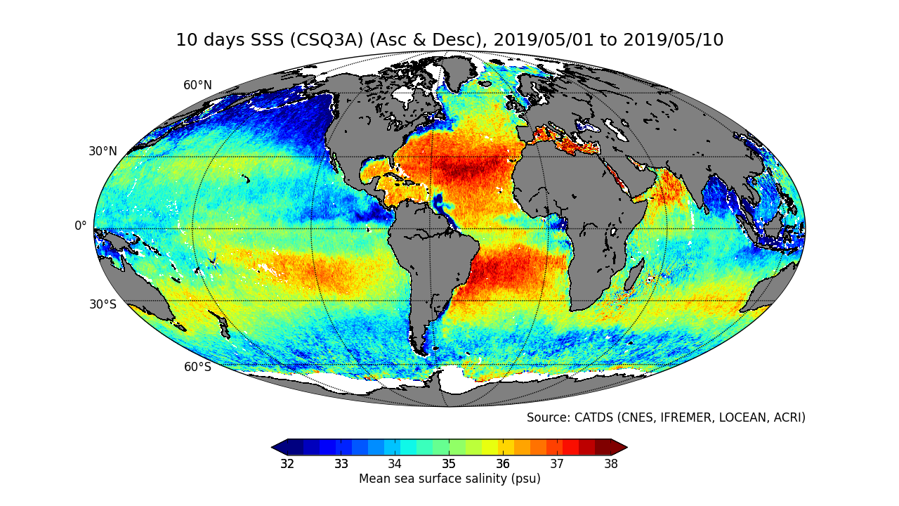
CATDS-PDC L3OS 3Q mixed - Debiased average 10 days & monthly salinity field product from SMOS satellite (mixed orbits)
Dataset extent
Map data © OpenStreetMap contributors
Tiles by MapBox
Tags
Data and Resources
To access the resources you must log in
-
RE06-MIXED
RE06-MIXED - Reprocessed products (01/2010 - 04/2019), mixed orbits
The resource: 'RE06-MIXED' is not accessible as guest user. You must login to access it! -
OPER-MIXED
OPER-MIXED - Operational products (05/2019 - now), mixed orbits
The resource: 'OPER-MIXED' is not accessible as guest user. You must login to access it! -
ATBD L3OS
Algorithm Theoretical Basis Document L3OS
The resource: 'ATBD L3OS' is not accessible as guest user. You must login to access it! -
Pros/cons table
The resource: 'Pros/cons table' is not accessible as guest user. You must login to access it! -
Reference
Boutin J., Vergely J.L., Marchand S., D'Amico F., Hasson A., Kolodziejczyk...
The resource: 'Reference' is not accessible as guest user. You must login to access it! -
CATDS Sipad
CATDS Sipad - Web-based interactive tool which allows subsettings and...
The resource: 'CATDS Sipad' is not accessible as guest user. You must login to access it! -
CATDS Web portal
CATDS Web portal
The resource: 'CATDS Web portal' is not accessible as guest user. You must login to access it! -
Unnamed resource
DOI of the product
The resource: 'Unnamed resource' is not accessible as guest user. You must login to access it!
Additional Info
| Field | Value |
|---|---|
| access_constraints | [] |
| bbox-east-long | 180 |
| bbox-north-lat | 83.5 |
| bbox-south-lat | -83.5 |
| bbox-west-long | -180 |
| contact-email | [email protected] |
| coupled-resource | [] |
| dataset-reference-date | [{"type": "publication", "value": "2019-05-17"}, {"type": "", "value": ""}] |
| graphic-preview-description | L3OS_3Q_2019.png |
| graphic-preview-file |  |
| GUID | 0f02fc28-cb86-4c44-89f3-ee7df6177e7b |
| licence | [] |
| metadata-date | 2020-05-29T10:54:10 |
| metadata-language | eng |
| resource-type | dataset |
| responsible-party | [{"name": "LOCEAN", "roles": ["principalInvestigator"]}, {"name": "ACRI", "roles": ["principalInvestigator"]}, {"name": "CATDS", "roles": ["author"]}, {"name": "CATDS (CNES, IFREMER, LOCEAN, ACRI)", "roles": ["publisher"]}] |
| spatial | {"type": "Polygon", "coordinates": [[[-180.0, -83.5], [180.0, -83.5], [180.0, 83.5], [-180.0, 83.5], [-180.0, -83.5]]]} |
| spatial-reference-system | WGS 84 / NSIDC EASE-Grid 2.0 Global (EPSG:6933) |
| spatial_harvester | true |
| temporal-extent-begin | 2010-01-12 |
Management Info
| Field | Value |
|---|---|
| Last Updated | 1 July 2020, 12:25 (CEST) |
| Created | 1 July 2020, 12:25 (CEST) |
