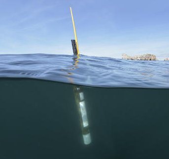
Argo float data and metadata from Global Data Assembly Centre (Argo GDAC)
Dataset extent
Map data © OpenStreetMap contributors
Tiles by MapBox
Tags
Data and Resources
To access the resources you must log in
-
Coriolis Web Site
The resource: 'Coriolis Web Site' is not accessible as guest user. You must login to access it! -
Argo GDAC snapshots access
Argo GDAC snapshots access
The resource: 'Argo GDAC snapshots access' is not accessible as guest user. You must login to access it! -
Web app avec carte interactive Flotteurs Argo ...
JCOMMOPS: Web app tous les flotteurs opérationnels
The resource: 'Web app avec carte ...' is not accessible as guest user. You must login to access it! -
Web app avec carte interactive Flotteurs ...
JCOMMOPS: Web app tous les flotteurs BGC-Argo opérationnels
The resource: 'Web app avec carte ...' is not accessible as guest user. You must login to access it! -
Unnamed resource
JCOMMOPS: Argo Opérationnel
The resource: 'Unnamed resource' is not accessible as guest user. You must login to access it! -
Carte interactive seule (tout BGC-Argo ...
JCOMMOPS: BGC-Argo opérationnel
The resource: 'Carte interactive seule ...' is not accessible as guest user. You must login to access it! -
Carte Argo France
The resource: 'Carte Argo France' is not accessible as guest user. You must login to access it! -
Unnamed resource
The resource: 'Unnamed resource' is not accessible as guest user. You must login to access it! -
Argo Dashboard
The resource: 'Argo Dashboard' is not accessible as guest user. You must login to access it! -
FTP ARGO
FTP ARGO
The resource: 'FTP ARGO' is not accessible as guest user. You must login to access it! -
Argo_ARGOLocations:Latest_LocationsWFS
Argo Latest Locations
The resource: 'Argo_ARGOLocations:Latest_L ...' is not accessible as guest user. You must login to access it! -
ERDDAP Download linkHTML
ERDDAP Download link
The resource: 'ERDDAP Download link' is not accessible as guest user. You must login to access it!
Additional Info
| Field | Value |
|---|---|
| access_constraints | ["No limitations on public access"] |
| bbox-east-long | 180.00 |
| bbox-north-lat | 90.00 |
| bbox-south-lat | -90.00 |
| bbox-west-long | -180.00 |
| contact-email | [email protected] |
| coupled-resource | [] |
| dataset-reference-date | [{"type": "publication", "value": "2000-09-12"}] |
| frequency-of-update | asNeeded |
| graphic-preview-file |  |
| GUID | 3df904de-e47d-4bf9-85a0-7c0942aff8b6 |
| licence | ["A user of Argo data is expected to read and understand this manual and the documentation about the data contained in the \"attributes\" of the NetCDF data files, as these contain essential information about data quality and accuracy."] |
| metadata-date | 2021-12-15T16:09:50 |
| metadata-language | eng |
| progress | onGoing |
| resource-type | series |
| responsible-party | [{"name": "Ifremer", "roles": ["publisher"]}, {"name": "Argo", "roles": ["author"]}] |
| spatial | {"type": "Polygon", "coordinates": [[[-180.0, -90.0], [180.0, -90.0], [180.0, 90.0], [-180.0, 90.0], [-180.0, -90.0]]]} |
| spatial-reference-system | WGS 84 (EPSG:4326) |
| spatial_harvester | true |
| temporal-extent-begin | 1995 |
Management Info
| Field | Value |
|---|---|
| Last Updated | 19 December 2021, 12:00 (CET) |
| Created | 1 July 2020, 12:25 (CEST) |
